Yesterday 6th July, on our second transect going south, we came across some more herring aggregations stretching for several miles along the seabed. The resulting catch revealed just short of 10 tons of clean herring (22-31 cm).
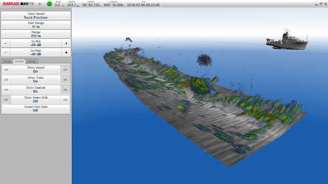
The schools were scattered all over the seabed, as can be seen on the 3D image from the multibeam data:
after trawl action, it was also possible to collect some broadband acoustic data of these schools using the EK80 echosounder:
During the survey this year we attempt to discriminate the herring by spawning component. The North Sea herring population can be divided into 4 distinct spawning components that use different spawning grounds from the Shetland Islands down to the English Channel (see map giving the different North Sea herring spawning grounds in red).
Those components spawning in the Channel do so in winter and therefore can be identified by the shape of their otoliths, which are distinctly different from the other components. Here a selection of otolith pictures taken so far:
Later on in the night close to the Moray Firth, we encountered some impressive feeding aggregations on our inter-transect going over the trenches in the southeast. The water column was filled with different layers and schools of fish. It was decided to await the start of the next transect in the morning to take a trawl sample... some impressions of the situation:
In order to gain improved insights into what enters the net a GoPro with a custom made housing and 2 external light sources was put into the net. Below some impressions of what the resulting video looks like:


No comments:
Post a Comment